
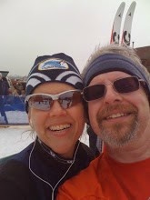
Just a quick one after work today. A little work on typical Crossfit skills afterwards. We'll hit it harder after tomorrow's ski lesson. Mostly downhill and uphill. Technique is improving. When I needed to stop, I tried to stay focused and continue moving as soon as was possible. Of course, Kirsten just skitters up the hill. At home, she's working on developing a butterfly pullup. Wow!
The map.
The Data:
| Name: | Balsam & Linden Loops |
| Date: | Feb 2, 2010 5:36 pm |
| Distance: | 2.33 kilometers |
| Elapsed Time: | 17:09.7 |
| Avg Speed: | 8.2 km/h |
| Max Speed: | 18.1 km/h |
| Avg Pace: | 07' 22" per km |
| Min Altitude: | 196 m |
| Max Altitude: | 254 m |
| Start Time: | 2010-02-02T22:36:36Z |
| Start Location: | |
| Latitude: | 47.107555º N |
| Longitude: | 88.552318º W |
| End Time: | 2010-02-02T22:53:46Z |
| End Location: | |
| Latitude: | 47.107413º N |
| Longitude: | 88.552498º W |
Click on this link to display the track in Google Maps. This link will be valid until Mar 4, 2010 8:31 PM PST.
Ciao,
Charles


No comments:
Post a Comment
How'dja do? Waddya think?