
After a busy couple of weeks of work and concerts, Kirsten and I had the 'perfect storm' of:
- Vacation from work.
- Weather terrible for rowing, but great for mountain biking.
- A houseful of company - Mom and endurance junkie, Jeff.


First things first - a good sleep in. Up by 8am, moving pretty casually at home. We had a look at a paper map of the trails and also the online interactive map. Online, the map has videos of most of the harder loops. After checking them out, we decide that the advanced trails of the Epic Ride would probably be over our heads. We'll just stick to the easy and intermediate loops.
Fueling up for the day started with breakfast at Suomi (if you must know, I had a ham, sausage, bacon and veggie omelette. And a cheat, I had to have one of those pancakes, with butter and syrup.) While waiting for the eggs, I planned out our route. In addition to the names of the loops, the map has numbers at each intersection. With a pen I copied down the sequence of numbers and turns to complete the route on my arm. We would simply make the turns at each sign - by the numbers!
Next a stop at Cross Country Sports in Calumet. New bar grips for Jeff and a few stories from Rick, the owner.
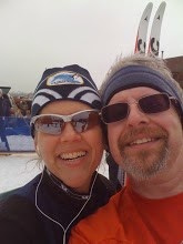
Fiiiiiinally we get to Copper Harbor a little after noon. One more trip to the gent's (I guess I was nervous,) shoes changed, bikes unloaded and we were ready to begin our Epic Ride. Exciting! Everything was looking like the map. Then we reached the first intersection. Great signs; but guess what - No. Numbers.
Aauuggghh! Kirsten volunteered to go back to the truck and get the map. What a sweetie. While she was gone, I made two discoveries. One was a pair of plaid boxer shorts hung in a tree. Sorry, no picture. Two was a small stand of raspberries and thimbleberries right at the intersection. I had a couple and saved one for Kirsten when she returned. Jeff didn't wasn't hungry. Too much FRENCH TOAST, I guess.
Fully informed, we made our way up the trail. By the time we got to the first crossing of US 41, Jeff figured out that this ride was going to be beyond his skillset. He headed down the hill to Copper Harbor and a less technical ride.
Kirsten and I continued with the plan. It was fun, challenging and a bit stressful. I suppose that's due in part to being unfamiliar with the trail. I was using the brakes a lot on the downhills. Of course, I always do; I am easily 'over-thrilled.'

Kirsten was a duck in water. After the initial climb, once she was in front, I never saw her until she stopped to wait. It was challenging, sometimes nerve-wracking. The bridges weren't as scary as I thought they would be - just scary enough! Plenty of room for riding, but no room for stopping and putting a foot down. We only walked our bikes in a few places. It was very cool!
We were pretty slow overall, stopping and map checking frequently. After finishing only one line of numbers on my arm, Kirsten was getting hungry. My back brake was behaving strangely, and I thought that Mom and Jeff might be ready for a change, so we took the short cut to a road and cruised back to town.
The timing was about perfect. We had a little visit with Ryan at Keweenaw Adventure Company, a friend from Houghton Cross-Country Sports days (ah, to have a bike shop on your street.) Mom showed up with packages, then Jeff soon after. We went to the Mariner for lunch (smoked salmon salad, vinegar & oil dressing; wheels back on the bus!) Jeff regaled us with his journey. He headed up Manganese Road toward Estevant Pines. On the way down, the loose gravel threatened to throw him, so he headed for the woods. Gonna need a new hat, our Jeff. No permanent harm done.

A good time was had by all. Tomorrow is a beach day! Here's the data:
| Name: | Epic Ride (some) | |
| Date: | Jul 15, 2010 12:31 pm | |
| Map: (valid until Aug 14, 2010) | Google Maps | |
| Distance: | 11.0 kilometers | |
| Elapsed Time: | 2:06:09 | |
| Avg Speed: | 5.2 km/h | |
| Max Speed: | 36.9 km/h | |
| Avg Pace: | 11' 26" per km | |
| Min Altitude: | 142 m | |
| Max Altitude: | 298 m | |
| Start Time: | 2010-07-15T16:31:52Z | |
| Start Location: | ||
| Latitude: | 47.467364º N | |
| Longitude: | 87.888281º W | |
| End Location: | ||
| Latitude: | 47.468039º N | |
| Longitude: | 87.887530º W | |
Look for more posts in the near future on Kirsten & Jeff's road bike excursions in a multi-post serial called:
Tour de Jeff!


No comments:
Post a Comment
How'dja do? Waddya think?